How it works
From landing to insight in under a minute
- 01
Drop your IGC
Import one flight or your whole logbook. Takeoff, landing and stats are detected automatically.
- 02
Relive it in 3D
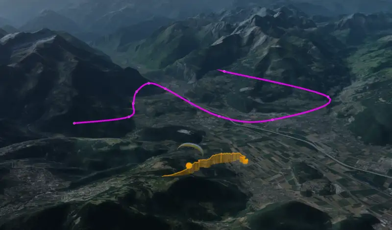
Replay your track over real terrain with thermals, glides and wind in context.
- 03
Progress and plan
Get coached on every flight, then let the optimizer plan your next XC with the weather of the day.
New in XCviewer 2.3
A coach for every flight. A route planner for the sky.
Our biggest release: a route optimizer that plans your XC like a navigation app, weather models built for mountain flying, and a coach that learns from every flight you upload.
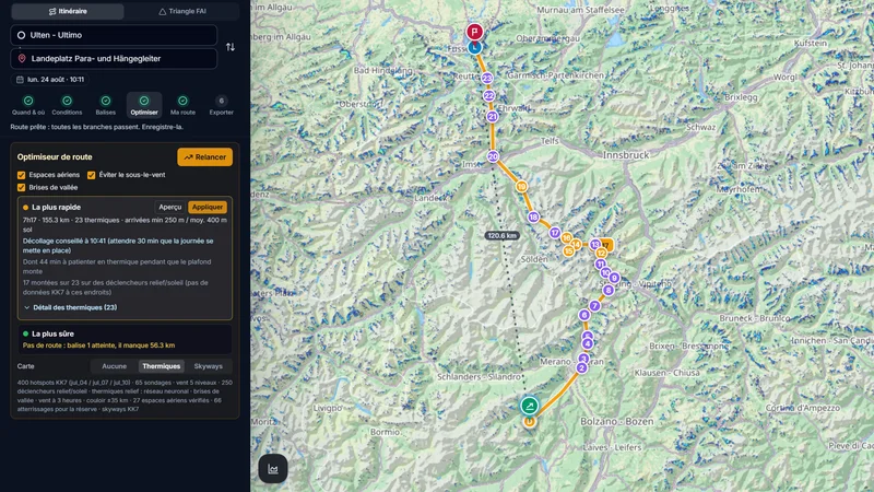
Like a navigation app, but in the air
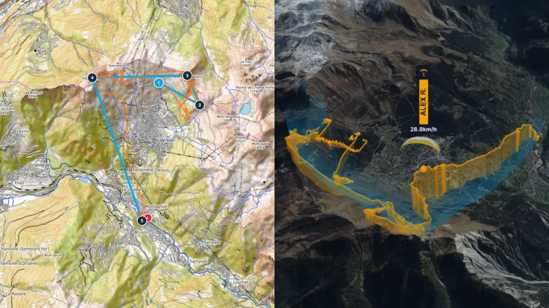
Place your takeoff and your goal. For the day and time you choose, XCviewer tests thousands of climbs and glides with your wing and suggests the fastest route it can really fly. Drag the line to pass elsewhere and it recomputes.
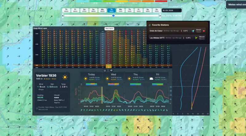
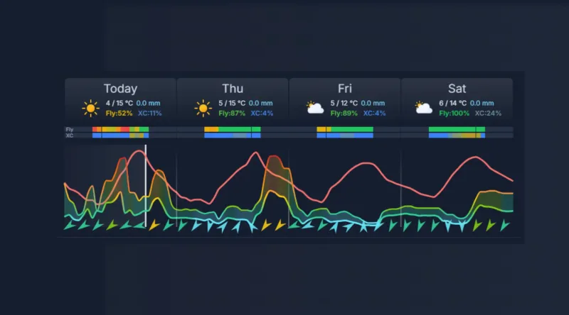
- Forecast wind at every altitude and hour
- Emagram: cloud base, thermal strength, ceiling
- Thermal model trained on thousands of real flights
- Valley breezes, lee sides and foehn warnings
- Your glider's polar: speed, sink and glide
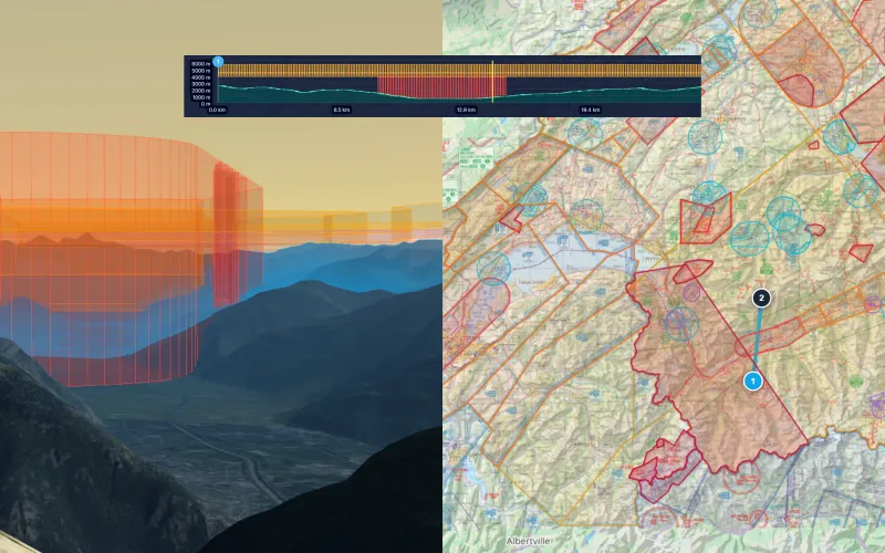
- Airspace floors and landings within reach
Where to Fly: XC Zones
The cross-country potential of every Alpine valley, day by day, for your glider.
Hike & Fly Planner
Plan X-Alps style days: fly when it works, walk when it is faster, relaunch from summits.
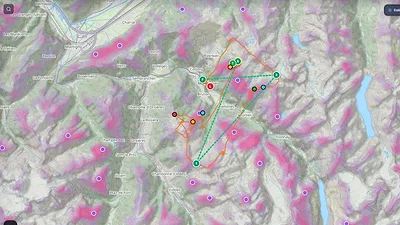
Thermal Model (neural network)
See where thermals are likely to trigger, by season and time of day, even where few pilots have flown.
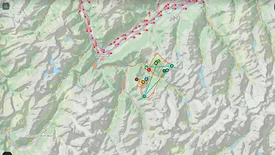
Valley Breeze Model
Up-valley by day, down-valley at night: the breezes that coarse forecasts miss, valley by valley.
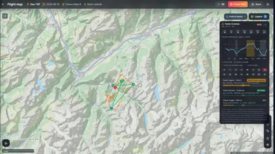
Foehn & Lee Waves (Alps)
A free foehn warning for the Alps: pressure gradient, wind aloft, lee waves and rotor zones.
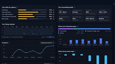
Pilot Coach
Your thermalling technique, safety habits and progress, measured across all your flights.
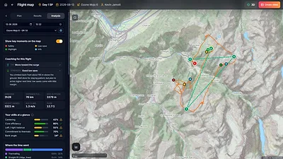
Flight Analysis in 3D & 2D
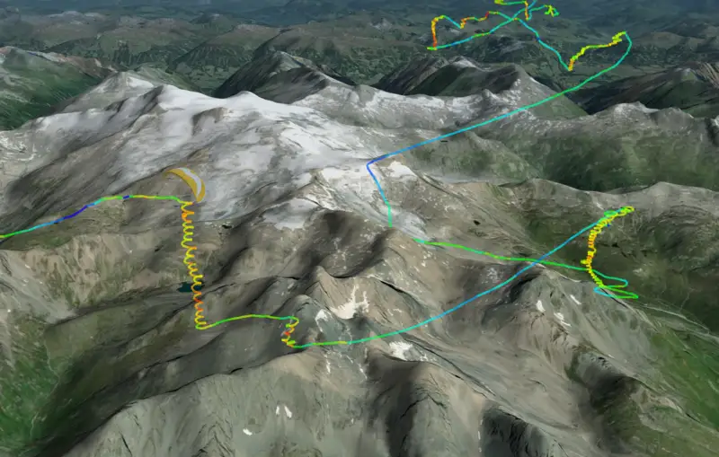
Every thermal, glide and safety margin of a flight, linked to the 3D replay and the map.
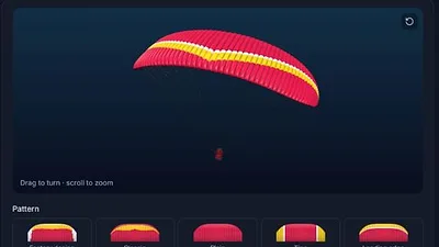
Glider Customization
Your wing, your colours, your polar: pick it from the catalogue, design it and watch it fly in 3D.
Models help you prepare; they never replace your judgement on launch. Always check the official forecast, the airspace and the conditions on the day.
Community
Longest shared flights
37
flights this week
2,579
km flown this week

Relief © Esri
Flights uploaded by country

Switzerland
19 flights this week

Austria
11 flights this week

Italy
12 flights this week

France
12 flights this week

Germany
18 flights this week

India
20 flights this week
150 flights uploaded in the last 30 days across 9 countries
Free plan · Drop an IGC and see it in 3D
One Platform for the Full Pilot Journey
From logbook and 3D analysis to route planning, weather intelligence, airspace awareness, and school training workflows.
Logbook & Flight History
Import IGC flights, organize your history, and keep your flying progression in one place.
Learn moreRoute Planning & 3D Preparation
Design routes and FAI tasks, visualize terrain in 2D/3D, and prepare decisions before takeoff.
Learn moreWeather & Airspace Intelligence
Use forecasts, weather stations, webcams, and airspace overlays to evaluate flyability and risk.
Learn moreSchool & Formation Workspace
Manage students, events, subscriptions, and educational follow-up in a dedicated school dashboard.
Learn moreSignature Tools
Tailored for Demanding Pilots
Showcase the capabilities that make XCviewer the preferred companion for training, competition preparation, and cinematic storytelling.
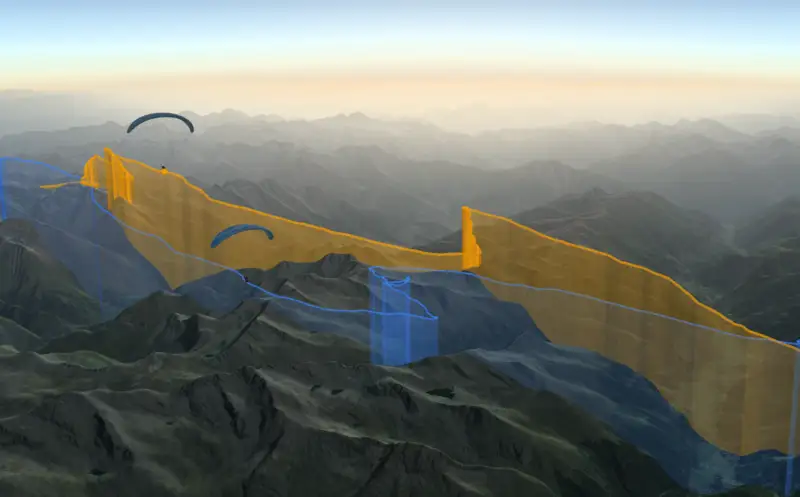
FEATURE 01
Flight Comparison in Sync
Replay multiple pilots side-by-side to compare tactics, match thermals, and learn from every glide.
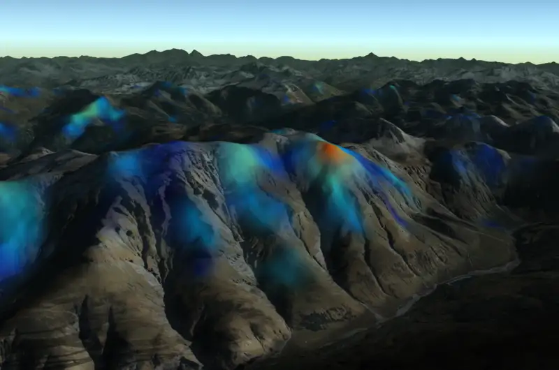
FEATURE 02
Thermal Overlay by KK7
Layer KK7 thermal hotspots over your route to understand convection strength and plan efficient climbs.
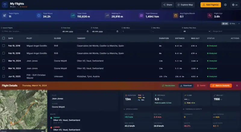
FEATURE 03
Smart Flight Collection
Organize your flights in a personal collection, relive your adventures, and share interactive replays seamlessly with friends.

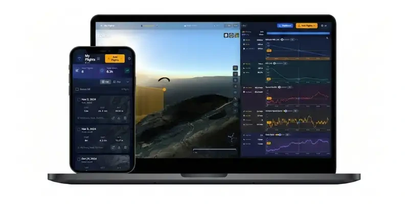

Turn every flight into a cinematic video
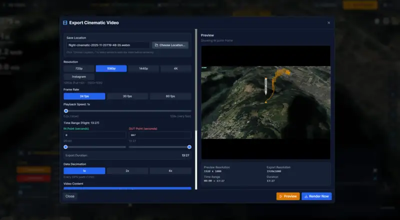
XCviewer analyzes your track and directs three camera styles in seconds. Pick one, tweak it if you like, and share it everywhere.
Create a flight videoRelive Every Flight for Free. Fly Further with Pro.
Start free, no credit card required. Upgrade when you're ready to plan XC, read the sky and fly smarter.
Free
Relive and share your flights
- 3D flight visualization
- Flight replay with camera follow-mode
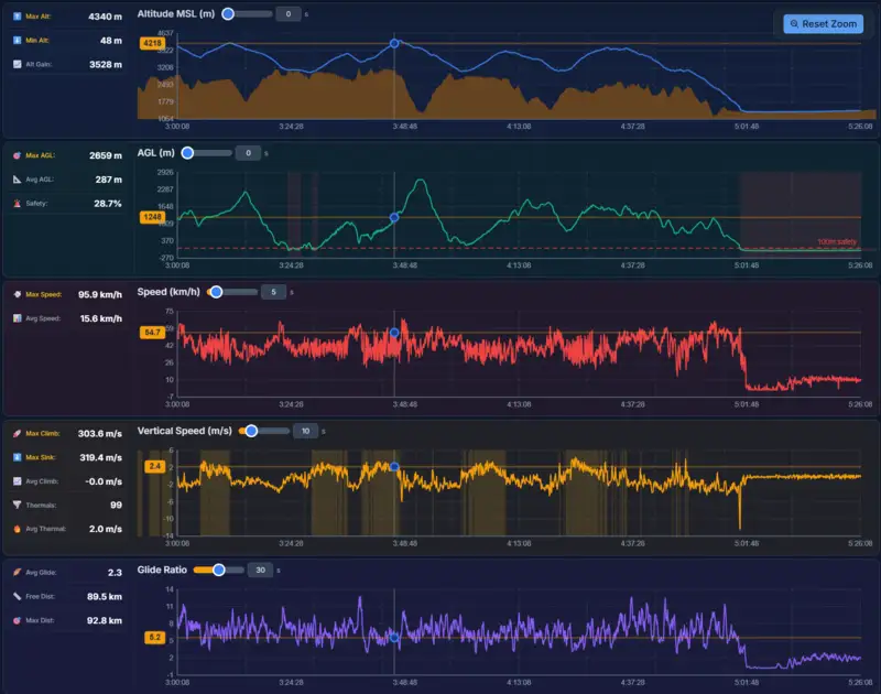
- Flight analytics & detailed graphs
- Pilot coach & flight analysis: the essentials
- Route optimizer: 3 free tries
- Where to fly: today’s XC zones
- Foehn & lee-wave warnings for the Alps
- 1 custom glider (design & polar)
- Today's forecast for your sites
- Share your flights with friends
- Mobile compatible
Public or private account
Public: unlimited flights
Your flights appear in the community under the username you choose. Up to 5 uploads a week and 30 a year.
Private: up to 2 flights
Only you and your friends see them. 1 upload a week, 5 a year.
Monthly
Plan, analyze and fly smarter
- Everything in Free, plus:
- Unlimited route optimizer, incl. Hike & Fly
- Where to fly: XC zones for the whole week
- Thermal model (neural network)
- Valley breeze model
- Full pilot coach & flight analysis
- Unlimited custom gliders
- XC Route Planner with FAI triangles
- Flyability score: Can I fly? Can I do XC?
- 5-day weather forecast
- Live wind layers, weather stations & webcams
- Airspace map & 3D airspace analysis
- Unlimited flights, no upload limits
- Private by default: share only the flights you choose
- Compare up to 10 flights at once
- KK7 Thermal visualization
- Advanced colorization (AGL, vario, speed, glide)
- Cinematic editor & video export
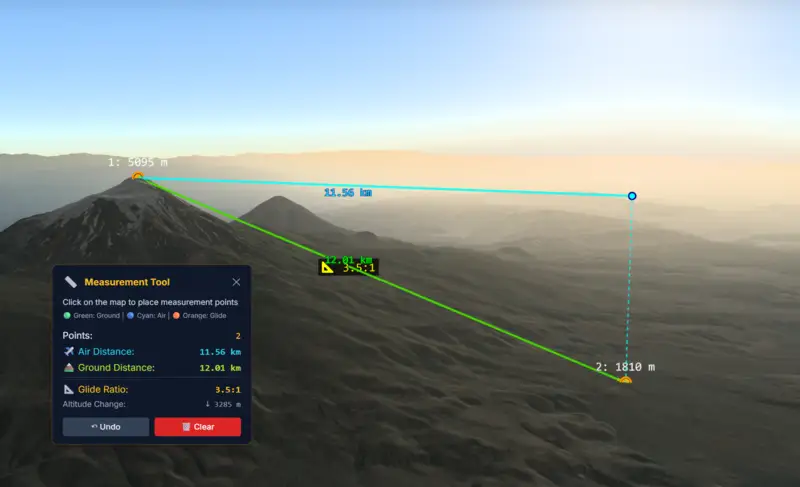
- Measuring tools
School Monthly
School manager workspace billed monthly
- School manager access
- Invite and manage up to 50 active students
- Active school students get full app access during their formation phase
- Overview of all student flights
- Create and manage formation events
- Manage student abonnement lifecycle
No hidden fees. Cancel anytime.
Ready to Get Started?
Join pilots worldwide analyzing their flights with XCviewer
Start Your Free TrialNo credit card required • Cancel anytime