The short answer
Google Earth is a good free option if you are comfortable converting files and only want to look at a track. If you want to open the IGC file as it is and get the climb rate, glides, graphs and a replay that follows your glider, a dedicated viewer like XCviewer is quicker.
Choose Google Earth if…
- You already use Google Earth Pro and know how to convert IGC to KML or KMZ.
- You want to add your own placemarks or combine the track with other KML layers.
- You only want to look at the track, not analyze it.
Choose XCviewer if…
- You want to drop the IGC file as it is, with no conversion.
- You want flight data: climb rate, glide ratio, and speed and altitude graphs synchronized with the 3D view.
- You want a replay with a camera that follows your glider, and a video export.
- You want to compare your flight with your friends’ flights in sync.
Feature by feature
| Feature | XCviewer | Google Earth |
|---|---|---|
| Works in the browser | YesWeb app, also on phones and tablets | PartlyThe web version opens KML files; Google Earth Pro is a desktop app |
| 3D replay of IGC files | YesFree | PartlyAfter converting the IGC file to KML or KMZ |
| Flight analysis (graphs, climbs, glides) | YesGraphs on the free plan; KK7 thermals and advanced colors in Pro | Not listed |
| Several flights replayed together | Paid planUp to 10 flights in sync | PartlyBy loading several KML files |
| Video export | Paid planAutomatic camera styles and a video Studio | PartlyManual, with Movie Maker in Google Earth Pro |
| Flight logbook | Partly2 saved flights free, unlimited in Pro | Not listed |
| XC route planner | Paid planFAI triangles, XContest-style scoring, wind-aware glide | Not listed |
| Airspace | Paid planAirspace map and 3D route analysis | Not listed |
| Paragliding weather | YesForecast free; flyability score, wind layers, stations and webcams in Pro | Not listed |
| Live tracking | Not listed | Not listed |
| Price | Free plan, Pro subscription (monthly or yearly) | Free |
“Paid plan” means the feature needs a subscription. “Not listed” means we could not find the feature on the tool’s website.
Information checked on October 7, 2026 from each tool’s public website. Features and prices change: if something is out of date, write to us and we will correct it.
SkyViz, flyXC, SeeYou, Google Earth, Ayvri, Doarama, XContest, XCTrack and the other names mentioned are trademarks of their respective owners. XCviewer is not affiliated with them.
XCviewer in action
Real screens from XCviewer. Each one links to a step-by-step tutorial.
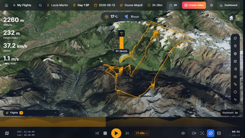
3D replay of an IGC flight on real terrain, right in the browser
See the tutorial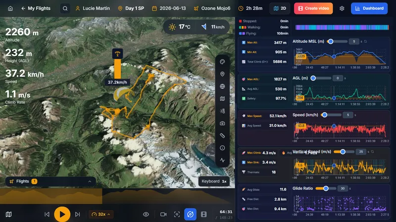
Dashboard with altitude, speed, climb rate and glide ratio charts linked to the 3D view
See the tutorial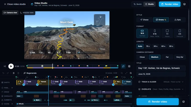
Video Studio: edit camera moves, timing and overlays shot by shot
See the tutorial
Try XCviewer with your own flight
- 1
Keep the original IGC file (not the KML): it holds all the data.
- 2
Create a free XCviewer account and drop the IGC file into the upload area.
- 3
Open it in 3D and press play.
Frequently asked questions
How do I open an IGC file in Google Earth?
Convert it to KML or KMZ first: XContest offers a Google Earth download on flight pages, and tools such as igc2kmz convert files. Then open the KML or KMZ in Google Earth Pro, or import it into Google Earth on the web.
Is XCviewer free like Google Earth?
XCviewer’s free plan opens IGC files in 3D with graphs and weather, and saves up to 2 flights. Pro adds unlimited flights, planning tools and video export.
What about Google Earth Studio?
Google Earth Studio can produce beautiful animations, but you build the camera moves yourself from a KML track. XCviewer creates the camera moves automatically from your flight.